
Home
Wind Cave Way, 10 June, 2023
Cache Hikers headed for the Beirdneau Ridge above the Wind Cave on a beautiful Saturday morning. Parking was already filling up at the trailhead at 8:25 a.m. Rain the previous night had dampened the trail but left no sloppy mud. The spring was gushing at an impressive rate.
After one mile we left the Wind Cave Trail at a switchback and turned onto an unsigned but distinct trail to the right, the Wind Cave Way Trail. We passed a hiker with trail tools and soon realized he had been working; the entire trail to the ridge was in excellent condition (except for the invasive weeds). In the last few years many rock reinforcements have been added and the tread has been leveled for good footing and drainage.
The vegetation was lush and green, with multitudes of wildflowers, shrubs, grasses, and periodic groves of trees. We identified arrowleaf balsamroot, big-leaf balsamroot, mule-ears, penstemon, waterleaf, death camas, larkspur, false Solomon-seal, stoneseed, yellow violet, bitterbrush, serviceberry, chokecherry, sagebrush, bigtooth maple.
Rest stops provided moments to enjoy wildflowers and the views of snow-capped Logan Peak, Mill Hollow across the canyon, and the Logan River below. Reaching the saddle and a junction with the Beirdneau trail about 11:00 a.m., we took a break then hiked southwest about 15 minutes to an overlook point where we ate lunch surrounded by flowers and spectacle.
Trip Summary:
- Seven hikers and one dog: Ralph, Teresa, Bree, Claire and Bam-Bam Dog, Kathy, Dave, and Jane (leader)
- Drove 8 miles to the Wind Cave trailhead
- Started hiking about 8:25 a.m., returned to cars about 2:00 p.m., with a half-hour lunch on top
- Temperatures were high 50’s at start, low 60’s at ridge, and mid-70’s when we returned to town
- Mostly sunny skies in the morning with gathering clouds and a little breezy after noon. No rain.
- Hiked about 6.7 miles with about 2450 feet elevation gain
Thanks to Jane for the narrative and photos, Dave P and Kathy for photos and Ralph for photos and GPS data, and to the volunteer trail workers for a great trail.
 |
|||
| The Wind Cave
Trailhead, where signs explain that the cave was
formed by water, not wind |
|||
 |
 |
||
| The trailside spring was gushing |
The Wind Cave Way Trail junction, 1
mile from the trailhead |
||
 |
 |
||
| Volunteers have done a great job
improving the trail |
The Wind Cave was visible toward the
west |
||
 |
 |
||
| A shady section of the trail |
The only switchback on the Wind Cave Way Trail | ||
 |
 |
||
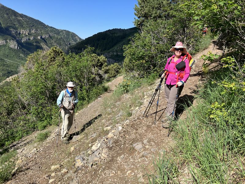
| After the
switchback, it's a long steady climb (1.3 miles
at 16% grade) to the ridge |
|||
 |
 |
||
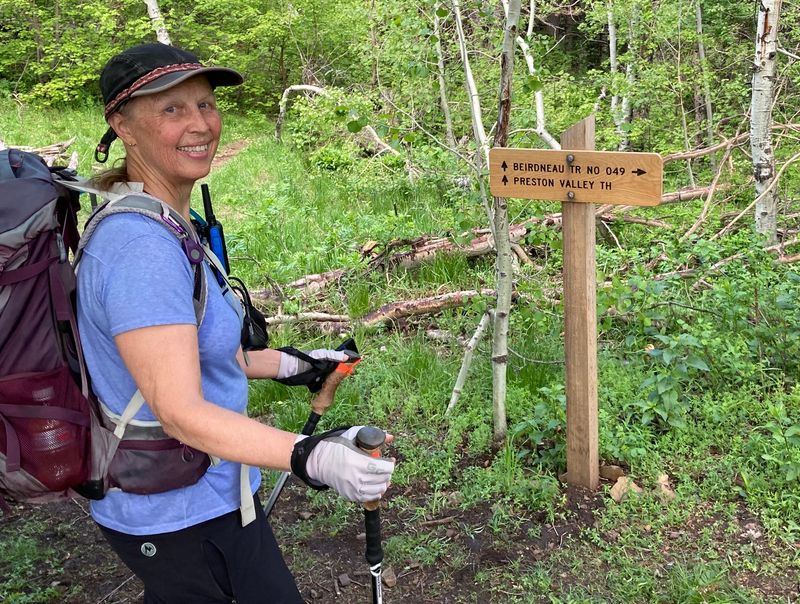
| New signs on
the ridge at the Wilderness boundary and the
Beirdneau Trail junction |
|||
 |
|||
| West on the
ridge for a great view of Cache Valley and the
Wellsville Mountains |
|||
 |
 |
||
| Lunch with a view |
Peaks to the south (larger
image) |
||
 |
 |
||
| Woodland star |
Mountain dandelion |
||
 |
 |
||
| Larkspur |
Arrowleaf balsamroot |
||
 |
 |
||
| Mule-ears |
Senecio |
||
 |
 |
||
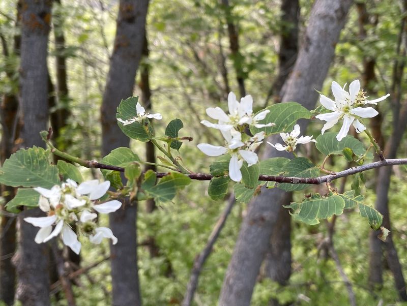
| False Solomon's seal |
Serviceberry |
||
 |
 |
||
| Cutleaf (bigleaf) balsamroot |
Chokecherry |
||
 |
 |
||
| Penstemon |
Mountain (goosefoot yellow) violet |
||
 |
 |
||
| Anise swallowtail butterfly on
arrowleaf balsamroot |
Spotted Towhee | ||
 |
|||
|
Our GPS track shows about 6.7
miles and 2450 feet
of ascent.
You can look at our route using
Google Earth
or download our GPS file.
|
|||