Description
|
Access
via US 89 in Logan Canyon, east of mile marker 468.
Turn south on
FR 024, opposite the Card Guard Station
(the sign reads "Summer Homes - Cache Archery Range -
Special Use Area - Card Canyon"). Cross the
river and follow the road to the left 0.7 miles until you
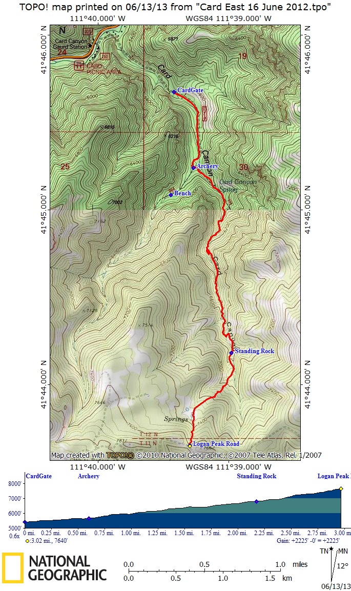
come to the locked gate. Park here and walk 0.6
miles to the archery range and the beginning of the Card
Canyon East and Card Canyon West trails. Card Canyon
East Trail follows the canyon bottom for 1.4 miles, then
switches back to the east side, arriving at a picturesque
standing rock at mile 1.6. The trail continues
another 0.1 mile, then turns toward the southwest,
arriving at an old beaver pond at mile 2.1 and the Logan
Peak Road at mile 2.4. Hikers may continue 0.75
miles west on the Logan Peak Road, then north on the Card
Canyon West trail, for a 7-mile loop hike, starting
and ending at the locked gate. Some car shuttle
options include combining this hike with Richards Hollow
or Spring
Hollow.
The trail from the standing rock
to the beaver pond springs had been lost due to lack of
use and maintenance. Cache Hiker volunteers found
and restored this section in 2005, and we have continue to
do volunteer maintenance work on this trail.
|